


Ready to get started?
Let’s talk! Our team of experts can help you clarify your needs and propose the most suitable solutions for you to successfully complete your mission.
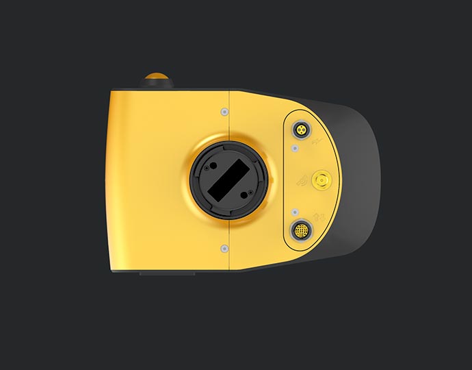
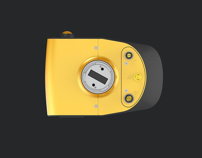
Mapper.
Jump into the LiDAR revolution.

Key figures
- View detailed characteristics
- Precision4 cm
- Accuracy4 cm
- Typ. flight speed10 m/s
- Max. AGL altitude70 m
- Laser rangeUp to 130 m
- Laser scannerLivox Horizon
- GNSS-Inertial solutionApplanix APX-15 UAV
- Scanner field-of-view81.7 ° x 25.1°
- Echoes per shotUp to 2
- Shots per secondUp to 240 000
- Scanning frequencyUp to 10 Hz
- Weight1.3 kg (2.9 lbs) batt. excl.
- SizeL 143 x W 98 x H 149 mm
- Autonomy1 hour typ.
- Power consumption19 W
A variety of mission profiles


Hardware
Designed to fit
any UAVs
Easy mounting on a variety of UAVs: multirotor, fixed-wing or helicopter drones. The Gremsy and DJI skyport integrations, or our custom-made mounting bracket allows for a swift set-up to get mapping quickly.
View the integrations list


Accessories
So, what’s included ?

1 Hardshell backpack
3.2 kg

1 Mapper
1.3 kg

2 batteries + 1 Charger
RRC 2040 - 10.80V

1 GNSS Antenna AV18
for YellowScan systems

2 USB keys
Sandisk 2to x2

1 DJI skyport or Gremsy adapters
for M300 / M200

CloudStation Essential
1 licence

Applanix POSPAC UAV

Technical support
1-year unlimite

Warranty
1 Year

1 Remote healthcheck

In-person or online training

Boresight calibration certificate
Optional add-ons

1 camera module
for Yellowscan Mapper

1 Mounting Bracket
for DJI M600
CloudStation Pro
1 licence

YellowScan LiveStation
1 licence

Extensions
Warranty and technical support extensions
Knowledge base
Discover our solutions by reading about our users’ experience in the field.

In the realm of environmental monitoring and analysis, the accurate assessment of vegetation plays a crucial role in understanding ecosystems. Drones equipped with advanced imaging technologies have revolutionized this process by providing efficient and precise data collection methods.

As part of a project directed by the archeologist Jean Soulat and the association “Archéologie de la Piraterie du XVII et XVIIIème siècle”, two excavation campaigns were organized to find traces of pirates...


Learn how the YellowScan Mapper LiDAR system was used in Antarctica to study the spatial distribution of penguins in their environment.

FlyThru was mandated by their client, the digital construction team at Eurovia Infrastructure, to survey an area for a roadway project.

Discover how Drone Expertise Centre produced highly accurate topographic data of the Parc Astérix theme park in France.

The stated objective was to produce LiDAR data that would ensure safety in the power line corridor by detecting dangerous vegetation.

Developing an understanding of changes to the forest structure caused by the gypsy moth outbreak with YellowScan’s Mapper LiDAR sensor.

The new YellowScan Mapper UAV LiDAR in action

Make your life easier
Invest in productivity-enhancing features that will simplify your workflow and give you confidence in the deliverables produced for your projects.


Everything you need in one backpack
Carry your LiDAR along with everything else you might need. This backpack is the size of carry-on luggage and fits in any airline overhead compartment.


Testimonial
They did it !

UAS Team Lead
University of Vermont (UVM-SA)
United States
Equipped with :
YellowScan Mapper

Digital Construction Manager
Eurovia Infrastructure
United Kingdom
Equipped with :
YellowScan Mapper
Be more productive in the field
For optimized productivity, we recommend a balanced 10 m/s flight speed for optimal point density.
10ha in 3min *
*flying at 70m AGL, 10 m/s, with 40% sidelap.
Withstand adverse events
Rain during a mission? Not an issue. Land safely thanks to the Mapper’s IPW55 protection.

Advanced calibration
All our systems are calibrated before shipment and come with a calibration certificate. Be ready to fly your system as soon as you receive it!

On-site training
YellowScan delivers complete training to new customers. The training is provided over 2 days and can take place at your premises or online.

Technical support
Our 1-year unlimited technical support from our experts enables you to confidently undertake your projects, whether you are new or experienced in the field.
