


Want to discover more?
Contact our team of experts or download our software datasheet below:
CloudStation LiDAR processing software.
Turn physical projects into digital realities.
The CloudStation is an evolutive and user-friendly LiDAR software, developed by YellowScan, to generate and visualize pointclouds.
Our software provides you with auto-detection of strips, in-depth configuration and LAS files exports to interface with all your tools.
Change the way your work with LiDAR data
Two CloudStation software bundles are available:
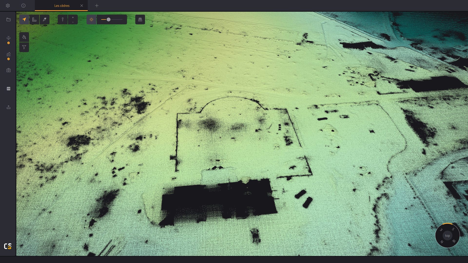
Point cloud classification
Export 3D classified pointclouds
Strip adjustment
Modify strips or flight lines and enhance the quality of your pointcloud.
Point cloud colorization
Export colorized pointclouds from simultaneous LiDAR + camera acquisition.
Key features:
- Combine the data generated from your flight with photos taken simultaneously to generate a colorized pointcloud
- Colorize and visualize your strips
- Automatic LiDAR–camera calibration and refinement
- Two colorization methods available
- Designed for our camera hardware
- Colorization from external orthophotos available
YELLOWSCAN CLOUDSTATION
Next-level LiDAR survey quality
Designed to improve data and set high standards regarding the quality of your surveying projects.
![]()
10 years’ experience in LiDAR technology
Our goal is to develop our skills and technologies to better serve our customers.
Our R&D team strives to innovate, develop new functionalities and improve the CloudStation on a day-to-day basis; so much so that a new release of the CloudStation comes out every 3 weeks.

Get expert advice and guidance for your next point cloud project
YellowScan’s knowledgeable team is here to support you, be it for a quick consult or training.
The CloudStation comes in an annual licensing scheme with a 1-year maintenance, including support and software updates.

Experience our pointclouds by downloading LiDAR datasets
Find out sample data captured with our LiDAR systems, select a specific sensor and download the associated dataset.

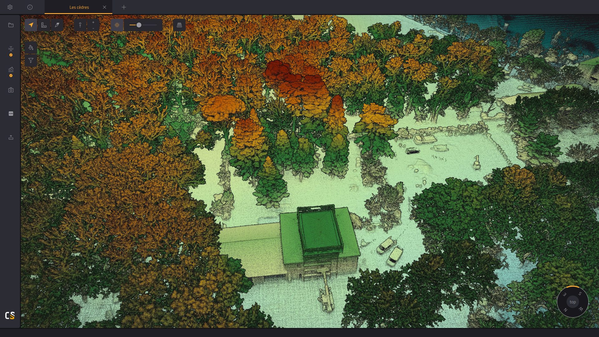
Point cloud visualization, inspection, and in-depth examination
The CloudStation’s powerful 3D engine allows you to effortlessly display billions of points, measure distances, and get information about your points in one click.
*Our CloudStation software is designed for desktop use and is not cloud-based.

Increased productivity. Maximized budget.
Extract, process, display and export LiDAR data right after a flight.
Effortlessly handle multiflight acquisitions in a single project.
Easily refine your trajectory thanks to the POSPac integration
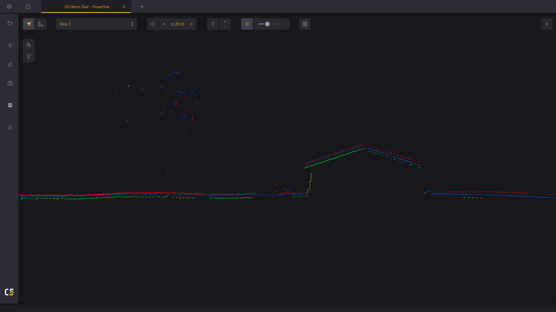
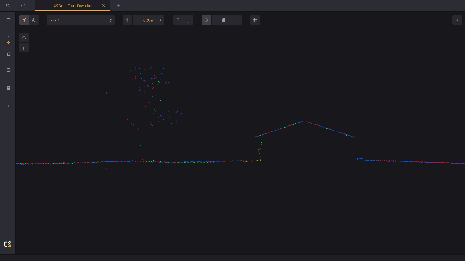
Vertical slicing of your generated point cloud
Get a better understanding of your generated point cloud.
- Measure denivelation.
- Assess the quality of the Ground classification, by checking the base of the vertical elements.
- Check the mismatch between flightlines, by measuring the strip-to-strip distance. Before, or after strip adjustment.
