Found 106 Results
Page 1 of 2
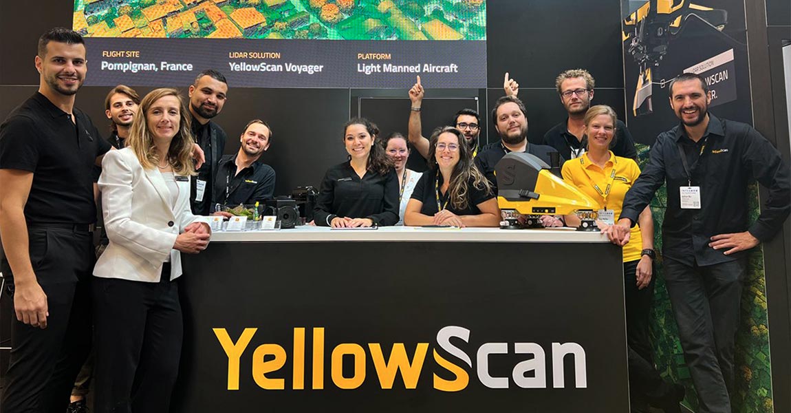
YellowScan announces EMLID as a Bronze Sponsor of the YellowScan LiDAR Convention 2024. Montpellier and Budapest – March 21st, 2023 – YellowScan, a global leader and designer of next-generation manned and unmanned LiDAR solutions, is pleased to announce EMLID as a Bronze Sponsor of its newly renamed LiDAR for Drone event, the YellowScan LiDAR Convention […]
22 March 2024
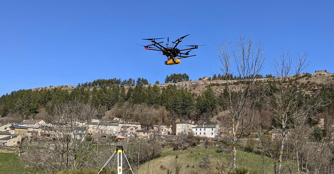
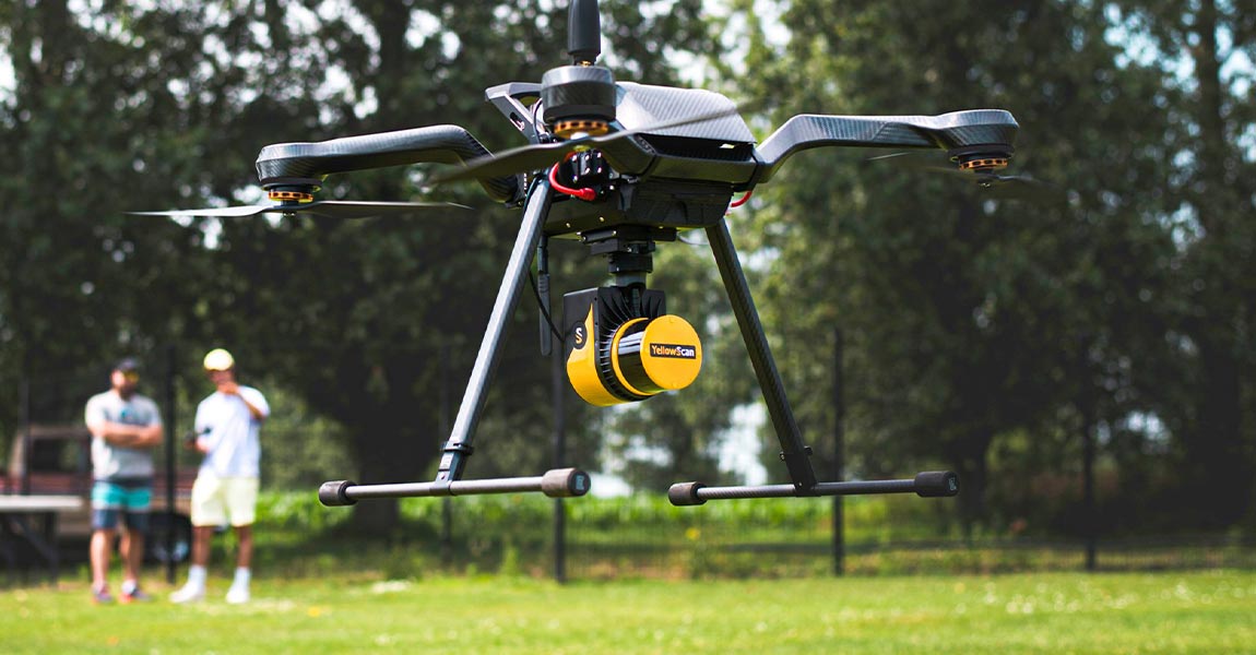
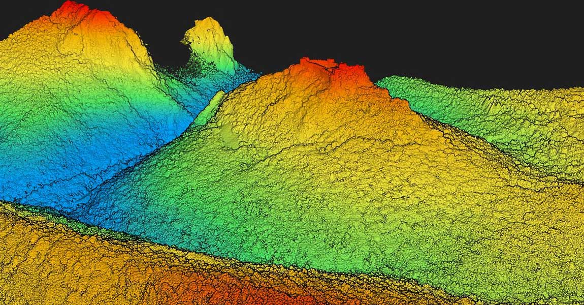
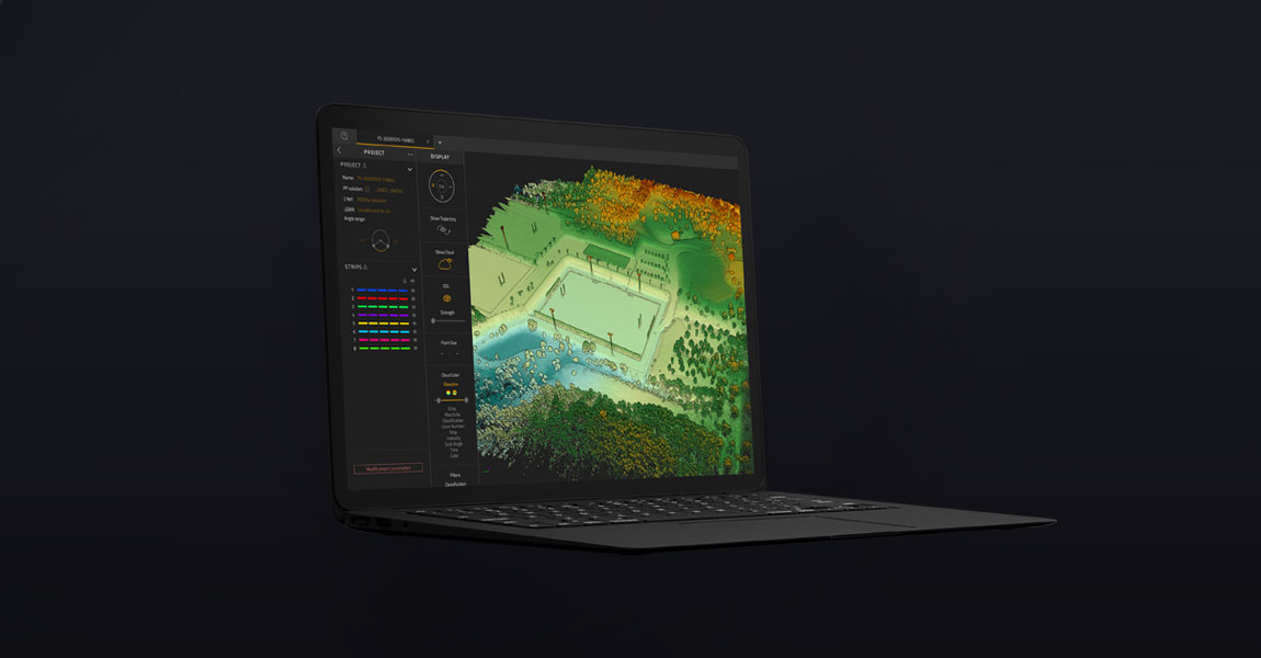
Introduction to Flight Planners A LiDAR drone is an unmanned aerial vehicle (UAV) equipped with Light Detection and Ranging (LiDAR) sensors. A LiDAR is an active sensor that uses inertial measurement to correlate where it is on the earth’s surface, resulting in a direct measurement of the earth. These measurements are visualized in a 3D […]
8 March 2024
YellowScan announces SBG Systems as a Silver Sponsor of the YellowScan LiDAR Convention 2024. Montpellier and Carrières-sur-Seine, France – February 9th, 2024 – YellowScan, a global leader and designer of next-generation manned and unmanned LiDAR solutions, is pleased to announce SBG Systems as a Silver Sponsor of its newly renamed LiDAR for Drone event, the […]
28 February 2024
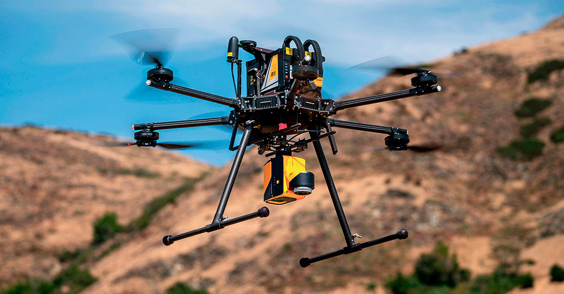
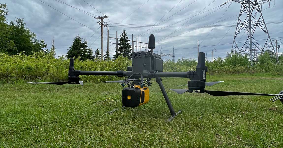
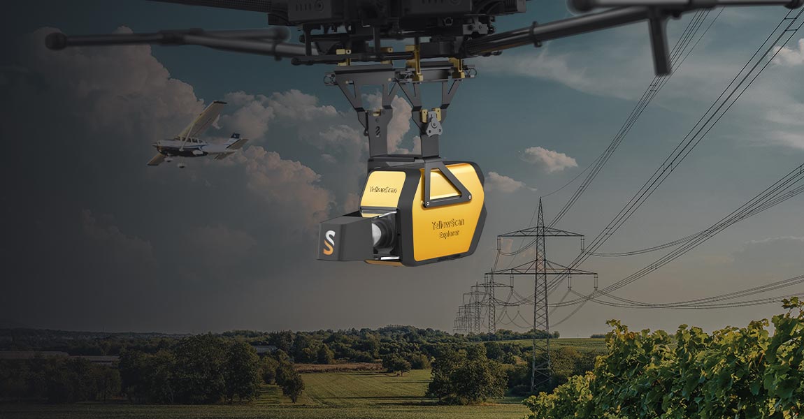
Challenge Carbonix, a leading manufacturer of commercial UAVs in Australia, became involved in a significant project when approached by an Australian power network seeking solutions for scanning their transmission and distribution lines in challenging, undulating terrain. They reached out to Carbonix to see if they had a system and sensor combination that could effectively meet […]
14 February 2024
YellowScan announces Applanix as a Gold Sponsor of the YellowScan LiDAR Convention 2024. Montpellier, France and Richmond Hill, Canada – February 9th, 2024 – YellowScan is pleased to announce Applanix as a Gold Sponsor of its newly renamed LiDAR for Drone event, the YellowScan LiDAR Convention, returning in April 2024. This year’s conference will feature over […]

13 February 2024
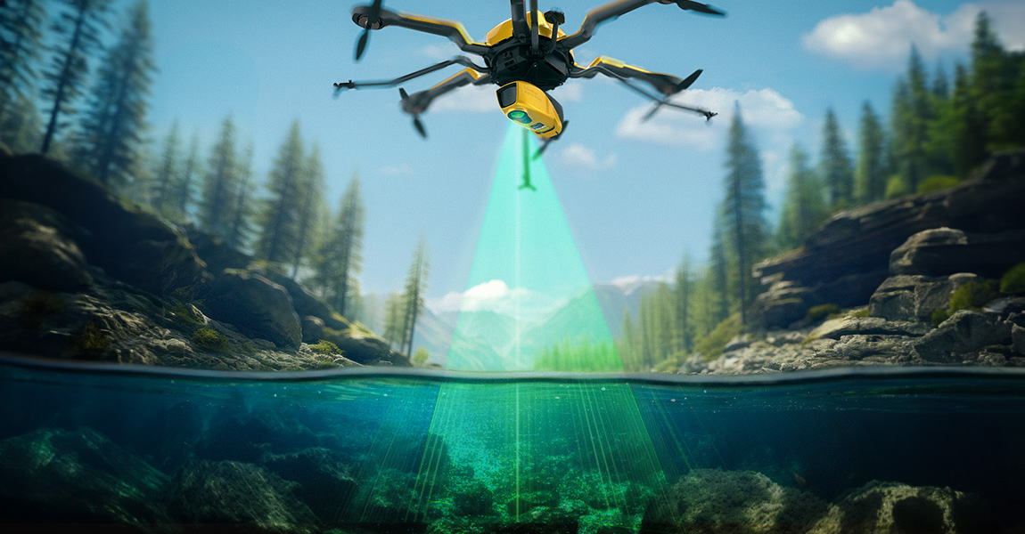
How does laser scanning work underwater? How can a laser penetrate water? What are the main benefits and challenges when using this technique? What happens when a laser pulse hits the water? This and more is explained in the following article about bathymetric LiDAR. Measuring underwater depths People have studied the underwater depth of river, […]
5 February 2024
Introducing the YellowScan Navigator: a groundbreaking bathymetric LiDAR System dedicated to coastal and river mapping from drones Montpellier, France, January 4th, 2024 – YellowScan, a global leader and designer of the next generation of manned and unmanned LiDAR solutions, is thrilled to announce the release of its new bathymetric system, the YellowScan Navigator, at the […]
Uncategorized
9 January 2024
Challenge The project came about because an engineering company sought high quality topographical data to reassess how they were going to resume mine operations. This involved tasks such as creating new roads, avoiding collapse-prone areas, and creating protection meshes, etc. The culmination of these efforts resulted in the development of a master plan to reactivate […]
14 December 2023
Initiated in October, the Next-2Digits project brings together 11 companies spanning across Europe. In collaboration with GrapheneEU, this consortium is committed to advancing expertise in the graphene domain and disseminating knowledge to diverse stakeholders. The main goal of this project is to pioneer the development of the next generation of sensors and imagers, leveraging the […]
Uncategorized
4 December 2023
Challenge European Hamsters are a protected species living in agricultural areas, often alongside field mice, which are considered pests. Lack of awareness about hamster presence leads to unintentional harm by farmers, endangering the European Hamster population. CRIFORA OG (a partnership between UMGEODAT Gbr and Grüne Umwelt) recognized the need to improve precision in detecting hamster […]
18 November 2023
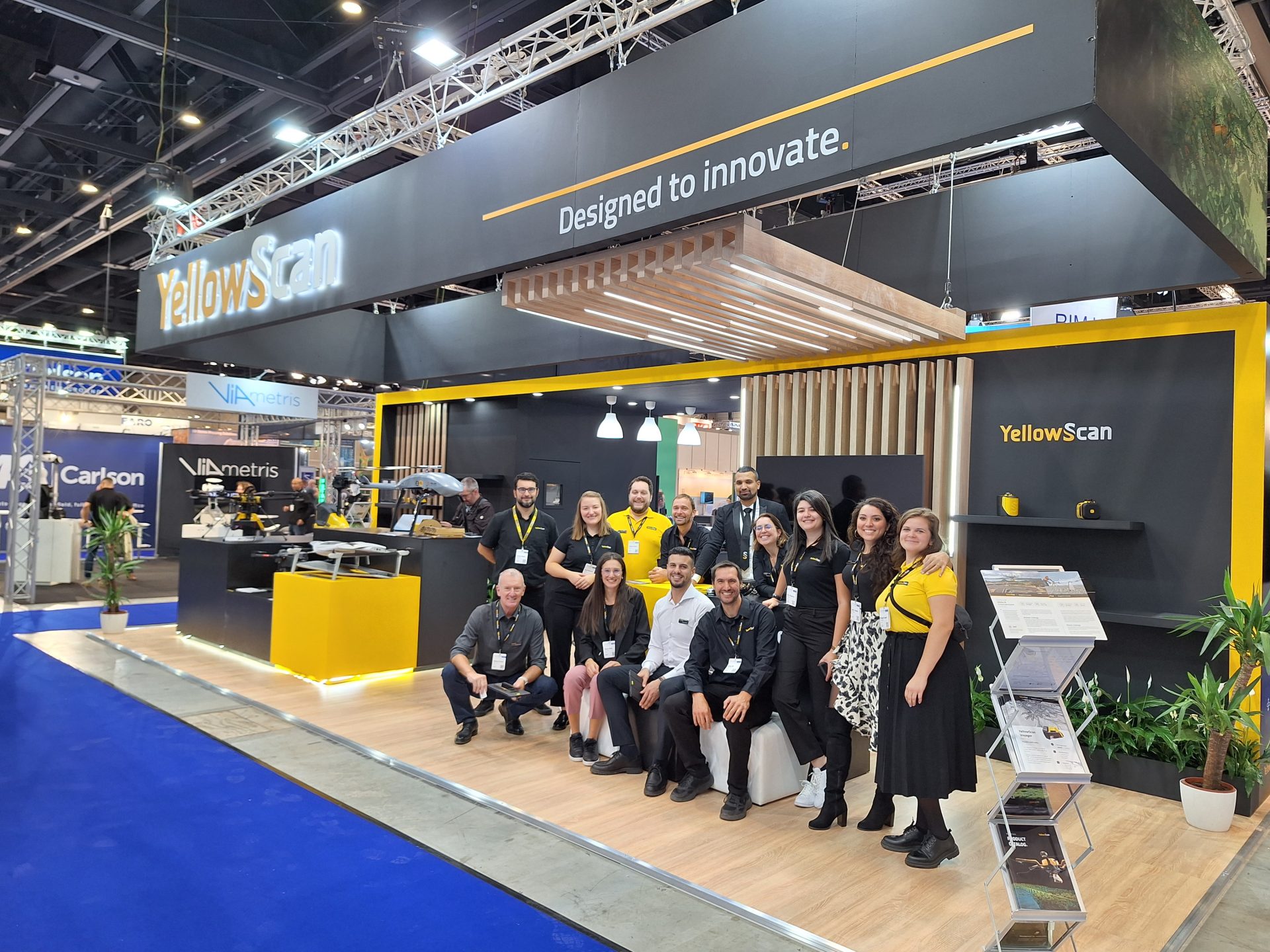
The Intergeo 2023 Conference took place in Berlin, Germany. We were thrilled to return for the 6th consecutive year as exhibitors! All three days were busy, filled with a continuous stream of meetings, from potential customers, to partners, to press interviews. We took advantage of our distributors and partners’ presence at the event to conduct […]
19 October 2023
Our primary goal is to provide the best quality products and support to our customers. In addition to the technical aspects of our work, we place customers at the center of our concerns. Why should you choose our brand? With YellowScan you’ll integrate an entire ecosystem with the same ease-of-use philosophy from the field, with […]
Uncategorized
10 October 2023
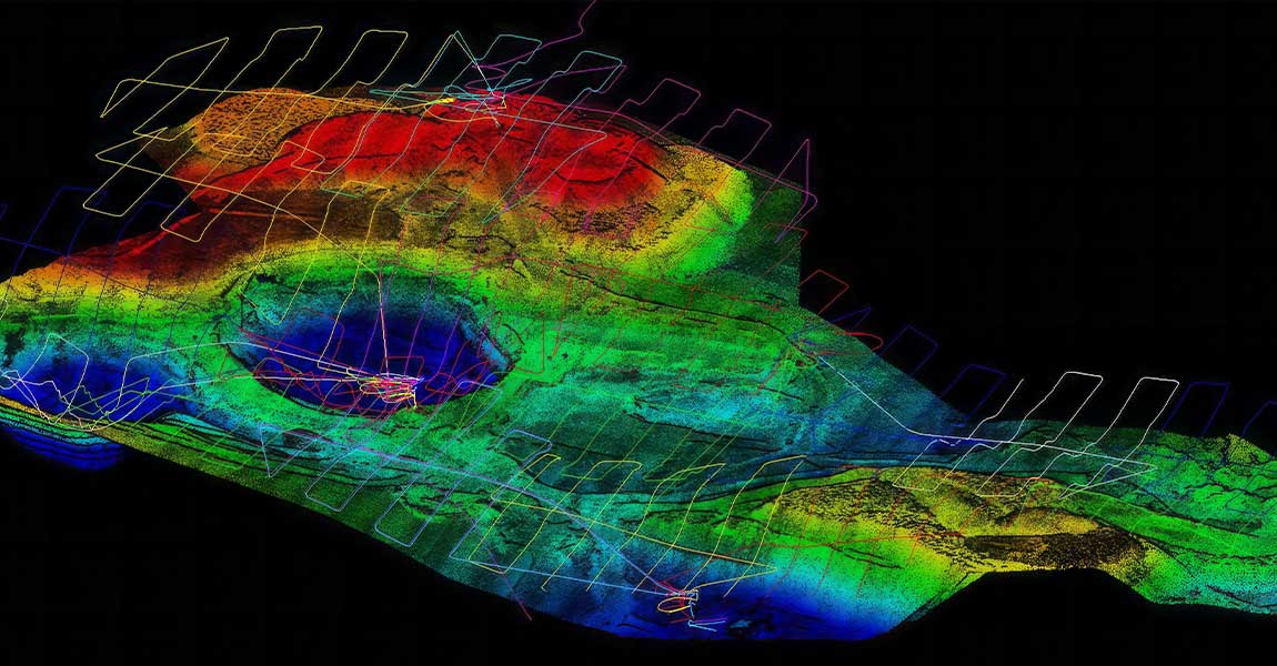
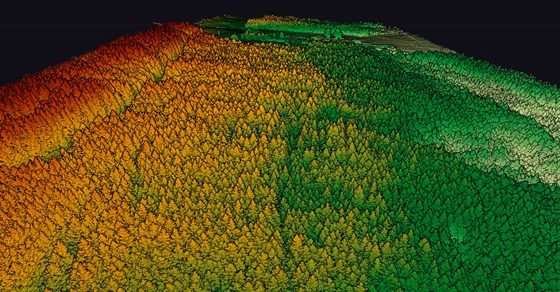
In recent years, advancements in unmanned aerial vehicle (UAV) technology have enabled the collection of accurate and rapid data for various applications. One such application is ground topography determination, crucial for a range of fields such as agriculture, urban planning, and environmental monitoring. This case study presents the utilization of the YellowScan Vx20-300 sensor on […]
25 September 2023
In the realm of environmental monitoring and analysis, the accurate assessment of vegetation plays a crucial role in understanding ecosystems. Drones equipped with advanced imaging technologies have revolutionized this process by providing efficient and precise data collection methods. This case study highlights the use of the Mapper and Mapper+ LiDAR systems, along with their specific […]
22 September 2023
The YellowScan LiDAR Convention will be held on April 18th and 19th, 2024 at the Domaine des Moures, near Montpellier, France. It is a great opportunity, for those interested in the LiDAR industry, to share experiences with experts in the field, receive feedback from peers, and be inspired by LiDAR users and the YellowScan team. […]

Uncategorized
What is a LiDAR for drones? In the realm of modern technology, LiDAR (Light Detection and Ranging) has emerged as a ground breaking innovation, particularly when combined with drones. This fusion empowers industries to redefine data acquisition, mapping, and analysis. Let’s take a closer look at LiDAR for drones and see how this dynamic pairing […]
1 September 2023
What is this laser technology making mapping possible through vegetation, in low-contrast or shadowy situations? LiDAR: Light Detection and Ranging Light Detection And Ranging (LiDAR) is a laser-based remote sensing technology. The idea behind LiDAR is quite simple: point a small laser at a surface and measure the time it takes the laser to return […]
25 August 2023
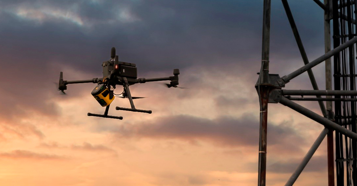
Challenge Our customer La Orizont carried out LiDAR inspections of a telecommunications tower for one of their partners. The purpose of this inspection was to create a digital twin that offers the possibility to perform several types of analysis: Line of sight analysis: Allows for the detection of objects that obstruct signal transmission. It also […]
21 August 2023
Charlotte, North Carolina, USA and Montpellier, France – July 19th, 2023 – YellowScan, a global leader in LiDAR solutions, is pleased to announce its partnership with Duncan-Parnell, a prominent provider of geospatial solutions. The collaboration aims to strengthen YellowScan’s distribution network in the Southeastern United States and surrounding areas and provide customers with enhanced access to […]
Uncategorized
21 July 2023
Our client, CIMA+, a renowned multidisciplinary company based in Canada, specializes in engineering, project management, and consulting services across various sectors. They were commissioned to conduct surveys of electrical powerlines. Challenge: CIMA+’s surveying department was internally commissioned by their engineers to perform surveys of the electrical wires, following unsuccessful attempts by an external provider. The […]
12 July 2023
Challenge This mission was started in response to a request from the Departmental Directorate of Territories, which lacked LiDAR equipment and therefore outsourced the entire data capture process to drone companies. The objective was to conduct a comprehensive modeling of four avalanche corridors in the Pyrenees, covering a total area of 430 hectares (1 060 […]
11 July 2023
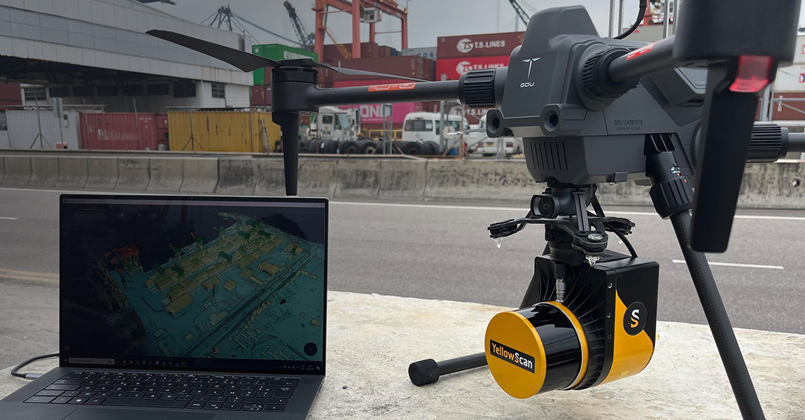
Montpellier, France and Shenzen, China – June 26th, 2023 – GDU Tech, a global supplier of enterprise UAV products and services, announces the strategic partnership with YellowScan, a leading LiDAR solution provider. This partership will enable GDU and YellowScan to offer more comprehensive solutions to their customers and widen the spectrum of industrial solutions. “GDU […]
Uncategorized
30 June 2023
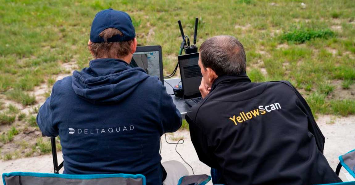
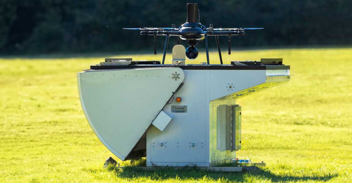
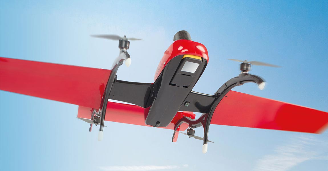
Our YellowScan LiDAR solution is now integrated into the latest DeltaQuad Evo UAV, making it the world’s first fixed-wing VTOL UAV with our combined YellowScan LiDAR mapping system & RGB camera module. Here’s what you need to know about this partnership: Groundbreaking collaboration pushing the boundaries of georeferenced colorized LiDAR data and terrain coverage. DeltaQuad […]
Uncategorized
15 June 2023
Nokia, our new partner, recently announced an exciting partnership with Citymesh, a prominent telecom operator based in Belgium. The collaboration entails the deployment of 70 state-of-the-art Drone-in-a-Box (DiaB) units from Nokia’s Drone Networks platform. This article was written by Jessica Reed and published by Avionics International. Read the full press release Download PDF File
Uncategorized
Challenge Following a successful research and development collaboration with a government agency, our customer GeoAerospace obtained a contract to perform airborne LiDAR capture in various forestry sites along the secluded west coast of Ireland. Their primary objective was to acquire high-quality airborne LiDAR data, as it is crucial for mapping remote mountainous regions as part […]
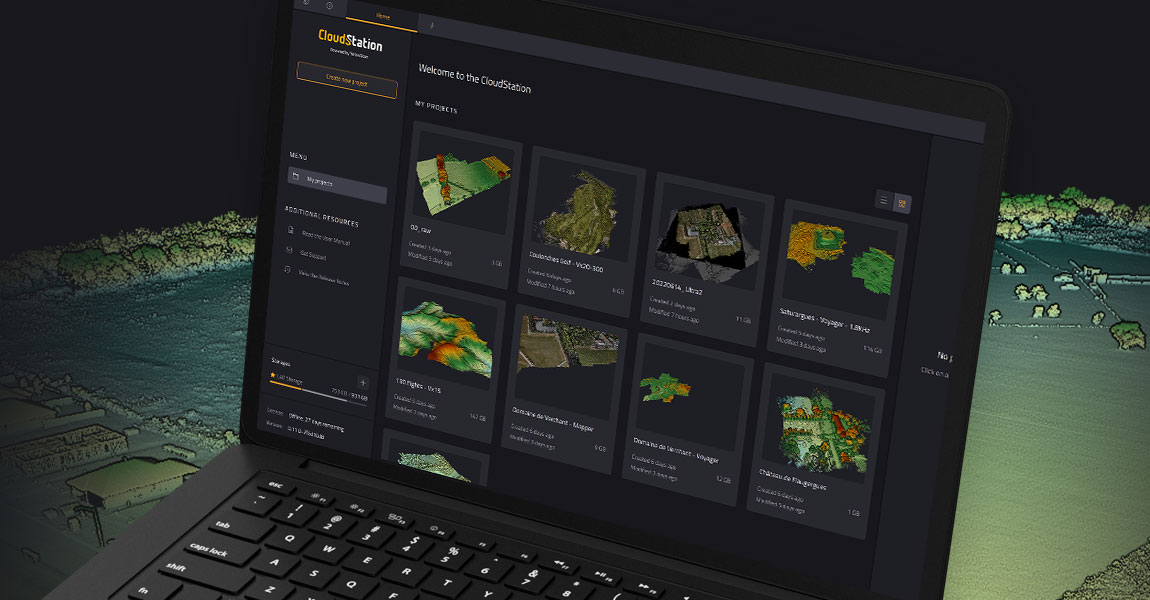
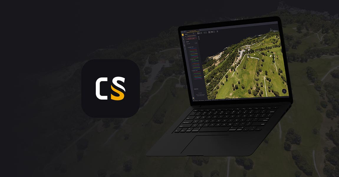
YellowScan streamlines trajectory refinement with latest CloudStation update Montpellier, France – June 1st, 2023 – YellowScan, a renowned global leader in designing cutting-edge LIDAR solutions, is excited to announce the seamless integration of POSPac into its proprietary software, YellowScan CloudStation. This update brings a major enhancement to the YellowScan CloudStation environment by integrating Applanix POSPac […]
Uncategorized
1 June 2023
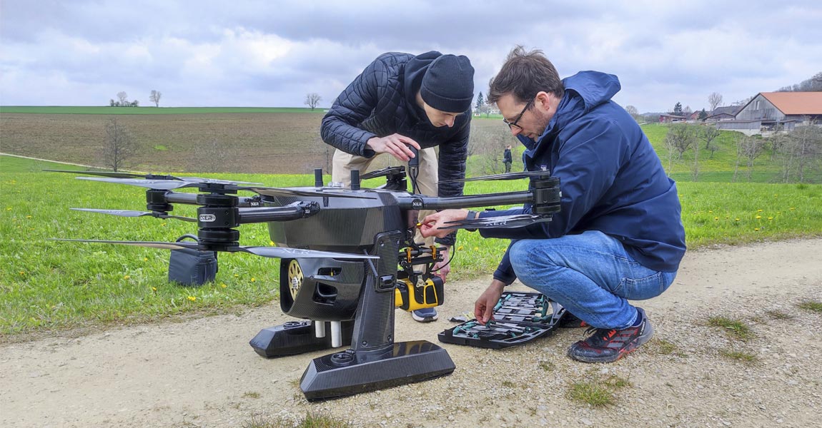
Yellowscan LiDAR has been tested and certified as compatible with the Xer X8 UAV platform. Montpellier, France and Zürich, Switzerland, 23 May 2023 – Xer Technologies AG, a Swiss leading manufacturer of long-endurance hybrid-electric drones and YellowScan, a global leader and designer of manned and unmanned LiDAR solutions are pleased to announce that the Yellowscan LiDAR has been […]
Uncategorized
24 May 2023
Back to basics A photosensitive sensor is composed of a multitude of pixels, a surface area that is mostly square in shape. These pixels are a component of photodiodes that convert light into an electrical signal. There is a common belief that the more pixels there are, the better the picture, but this is not […]

15 May 2023
Challenge: L’Avion Jaune, a company specialized in the production of earth observation data (multispectral imagery and LiDAR), is well known by key players in geomatics and environmental management in France. They took part in a study to model the hydrographic network and the hydraulic functioning of a wetland, within a nature reserve in New Aquitaine, […]
10 May 2023
Infinity Success Solutions Sdn Bhd has been appointed as the New Distributor in Malaysia Montpellier, France and Kuala Lumpur, Malaysia – March 1st, 2023 – YellowScan, a global leader and designer of next generation LiDAR solutions, announces an addition to its global distribution network, Infinity Success Solutions Sdn Bhd (ISS. ISS provides end-to-end geospatial solutions […]
Uncategorized
28 March 2023
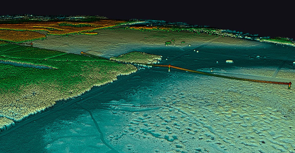
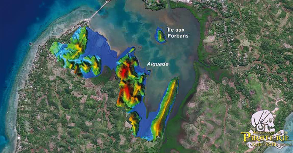
Business challenge As part of a project directed by the archeologist Jean Soulat and the association “Archéologie de la Piraterie du XVII et XVIIIème siècle”, two excavation campaigns were organized to find traces of pirates in Mauritius Island and Sainte-Marie island (Madagascar). There were two parts to this project: one with divers and an underwater […]
23 March 2023
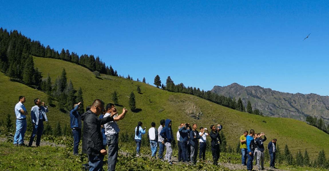
Masarang Foundation, a 20-year-old ecological organization founded by world-renowned forester Dr. Willie Smits and based in North Sulawesi, Indonesia, has reforested 35 million trees to date. As forests are an essential source of clean water, air, and food for the surrounding communities, Masarang Foundation’s reforestation efforts have had a significant impact on the region’s well-being. […]
10 March 2023
https://vimeo.com/773322048 The true story of the pirates [French video] “Popular figures in literature and cinema, pirates scoured the seas in the 17th and 18th centuries. In the wake of two excavation campaigns directed by the archaeologist Jean Soulat, Stéphane Bégoin leads us on their trail in Mauritius and Madagascar. He also attempts to discover, on […]

9 January 2023
What was the challenge? L’Avion Jaune and Ginger CEBTP, a geotechnical study office, were mandated by the Departmental Council to conduct a risk assessment study of rockfall hazards on their road networks. The end goal was to implement the most suitable prevention measures to protect road users. The natural degradation of limestone cliffs generates landslides […]
7 December 2022
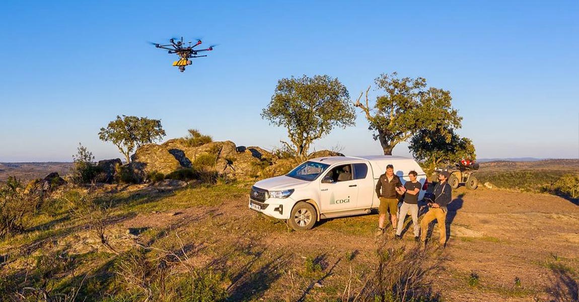
What was the challenge? The first project CDGI worked on, and for which they equipped themselves with a YellowScan LiDAR, was the Charles de Gaulle Express. The SNCF, plus the companies contracted for the works, wanted to compare LiDAR surveys with those done with traditional methods, in a real work situation. The problem CDGI had […]
2 December 2022
What was the challenge? The goal of this project was to generate a model of the Huasco Pellet Plant, in Chile, property of the state-owned company CAP Mining. This site pelletizes iron ore from Los Colorados mines by reducing impurities of the mineral. The Huasco Pellet Plant, having begun operations in 1978, has come across […]
11 November 2022
The Intergeo 2022 Conference was held on October 18th to 20th in Essen, Germany. We were excited to be back for the 5th year in a row as exhibitors! The first two days were extremely busy and rocked by back-to-back meetings, going from potential customers, to UAV manufacturers, to press meetings, coupled with a steady […]
26 October 2022
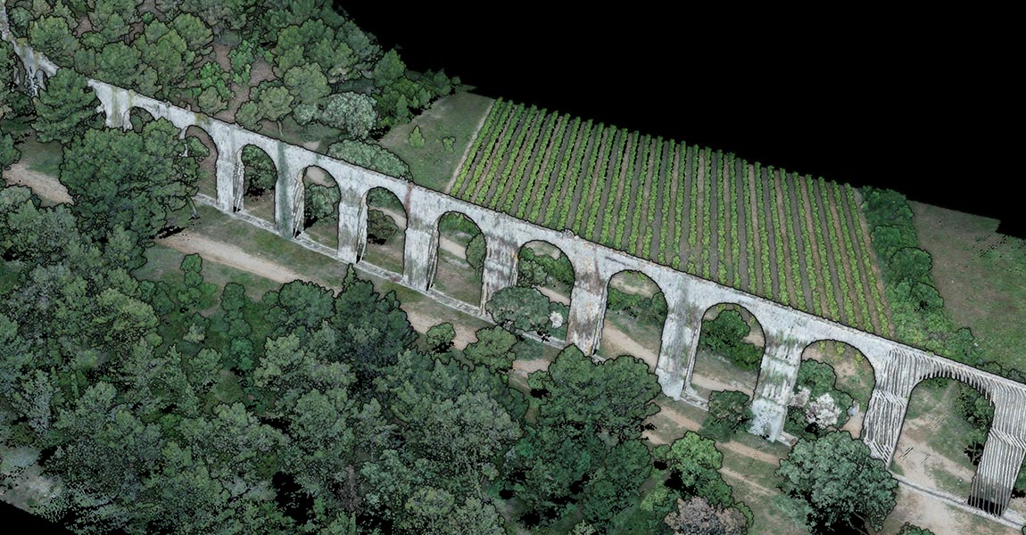
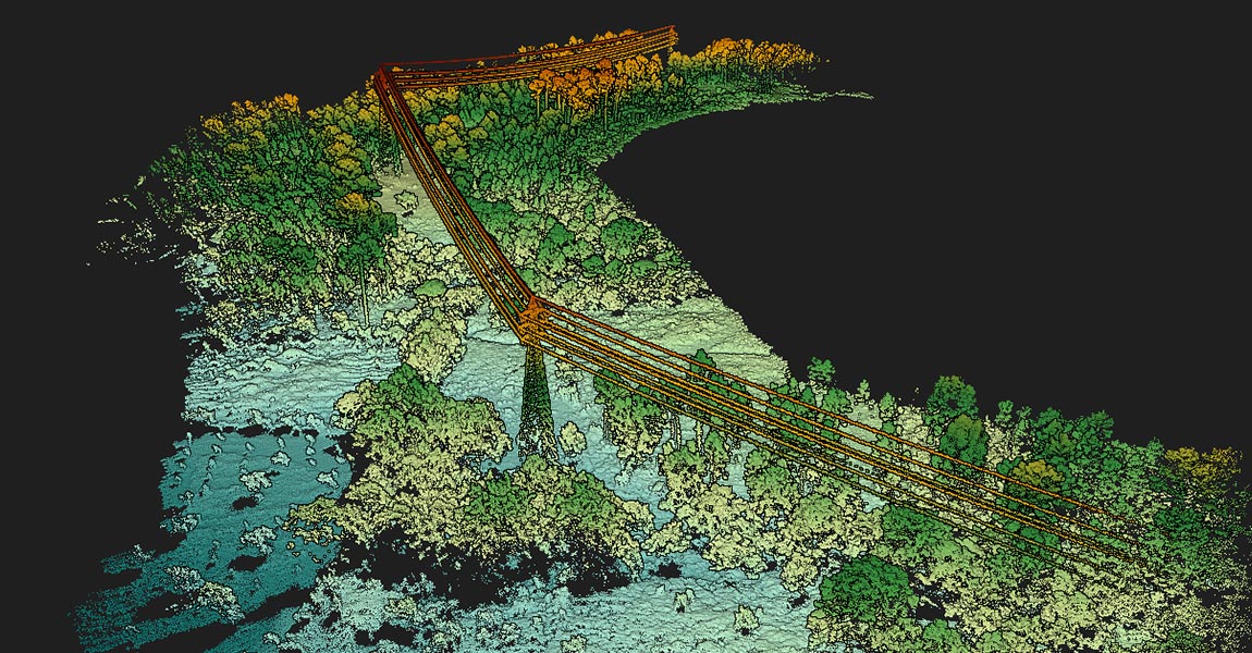
How did data captured by drones help create a digital twin of the Széchenyi Chain Bridge? This project, led by our customer Ventus-Tech in Hungary, aimed to establish a baseline and record the status of the bridge before its restoration started. The scan of the present state of the bridge will help to compare its […]

12 October 2022
The Mapper series and new Surveyor Ultra are now fully compatible with Gremsy’s quick-release solutions. Montpellier, France and Ho Chi Minh City, Viet Nam – September 06th, 2022 – YellowScan, a global leader and designer of manned and unmanned LiDAR solutions, is pleased to announce that its LiDAR Mapper-series and Surveyor Ultra are now fully […]
6 September 2022
The YellowScan Mapper+ OEM LiDAR mapping solution will be integrated into the FIXAR 007 Montpellier, France and Riga, Latvia – August 29th, 2022 – YellowScan, a global leader and designer of next-generation manned and unmanned LiDAR solutions, is delighted to partner with FIXAR, a European unmanned aerial vehicle developer. FIXAR provides a range of solutions […]
29 August 2022
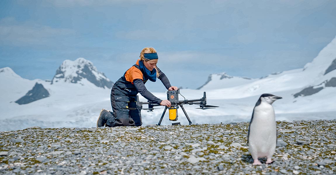
This penguin mapping project is part of an interdisciplinary expedition to Antarctica. This multimonth research expedition on a sailboat covered several themes: climatology, sociology of science, chemistry of microplastics, microbiology, biogeochemistry and ecology of penguins. This last theme aims to map the breeding sites of the penguins. Lana Lenourry, a student researcher from Juste 2C, […]
27 July 2022
YellowScan is growing its presence in Africa with newest South African distributor Montpellier, France and Johannesburg, South Africa – July 27th, 2022 – TeleEye South Africa, established in 2006, are early pioneers of digital surveillance and remote video monitoring solutions, offering specialised commercial and industrial imaging applications from world leading brands. GoUAV, their UAV […]
The update increases your productivity and simplifies multiflight data processing YellowScan has developed a new global release of the CloudStation which focuses on increasing their customers’ productivity. CloudStation provides a complete software solution to create and manipulate point cloud data. It allows you to extract, process and display data immediately after the acquisition flight in […]
26 July 2022
Voyager is the most precise multi-mission LiDAR platform from YellowScan YellowScan released the Voyager, an entirely new product line integrating the VUX-120 from RIEGL, designed for those who need less than 1 cm precision and the ability to efficiently cover complex and vertical targets with ease. On top of that, its weight of 3.5kg (7.7lbs) […]
11 July 2022
YellowScan’s partner FlyThru, one of the UK’s leading providers of unmanned LiDAR surveys, was mandated by their client, the digital construction team at Eurovia Infrastructure to survey an area for a project. As one of the global leaders in transport infrastructure and urban development, Eurovia builds and maintains roads, motorways, railways, airports and tramways, and […]
5 July 2022
As entertainment in general, particularly video games be it traditional console games or virtual reality, strive to be as accurate as possible in their depiction of real-world locations. The industry is turning to LiDAR technology to help it build 3D models in order to give players the best experience possible. YellowScan Vx15 on a DJI […]
28 June 2022
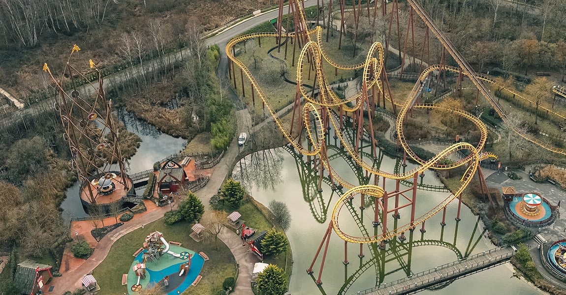
Drone Expertise Centre’s client, the Parc Asterix*, in France, had an objective to produce very precise and complete topographic data on the whole of the amusement park and its surroundings. This mission was done as part of an impact study for a future project where it was essential to have highly resolution and accurate data […]
31 May 2022
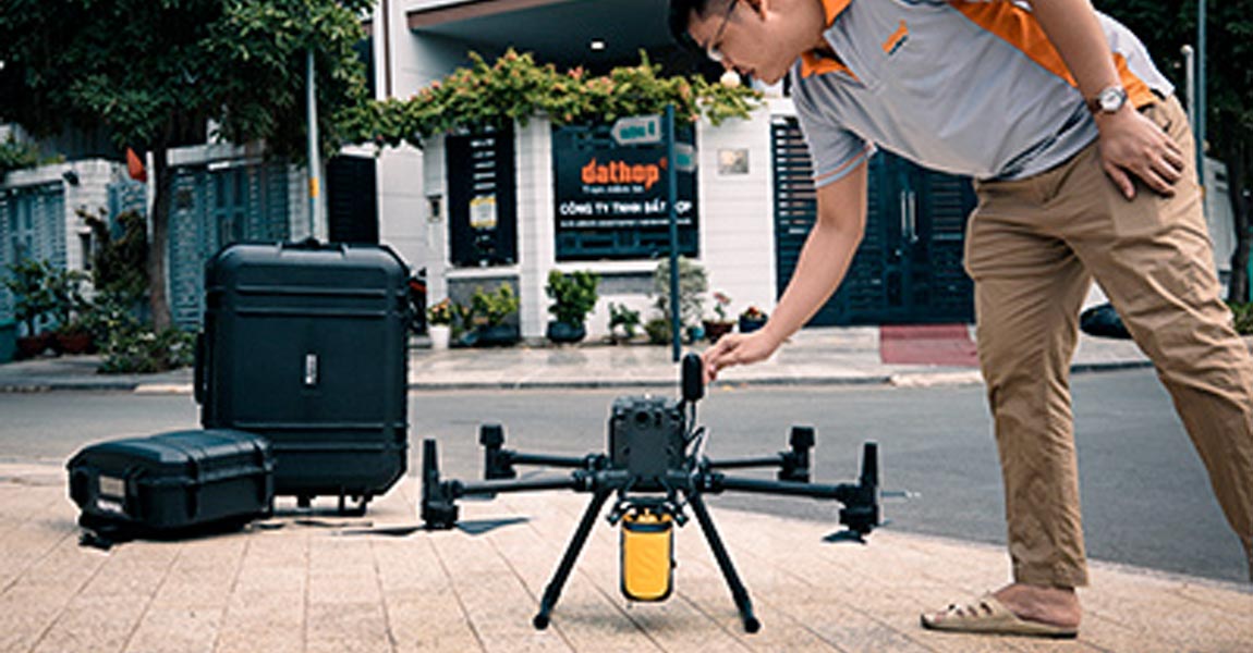
Growing the YellowScan Global Support Network in South Asia is a Priority Montpellier, France and Ho Chi Minh City, Vietnam – May 24th, 2022 – YellowScan, a global leader and designer of next generation manned and unmanned LiDAR solutions, announces the newest addition to its ever-growing YellowScan Global Partners Network, Dat Hop Co. Ltd. Established […]
24 May 2022
RIEGL has long been one of YellowScan’s OEM suppliers and technology partners and an important part of its Global Community Montpellier, France and Horn, Austria – May 3rd, 2022 – YellowScan, a global leader and designer of next generation manned and unmanned LiDAR solutions, is happy to announce RIEGL as a sponsor to join its […]

3 May 2022
YellowScan’s Global Ecosystem Continues to Grow and Improves its Reach Across the US Montpellier, France and Brick Township, New Jersey, USA – April 14th, 2022 – YellowScan, a global leader and designer of next generation manned and unmanned LiDAR solutions, announces a new organization to join its YellowScan Global Partners Network, Terrestrial Imaging. Terrestrial Imaging […]

14 April 2022
YellowScan is Proud to Welcome Fischer Connectors to its Global Community Event Montpellier, France and Saint-Prex, Switzerland – April 12th, 2022 – YellowScan, a global leader and designer of next generation manned and unmanned LiDAR solutions, announces the addition of Fischer Connectors to its list of sponsors for YellowScan’s Global Community conference LiDAR for Drone […]

12 April 2022
YellowScan Global Support Community is growing in Latin America Montpellier, France and Mexico City, Mexico – April 5th, 2022 – YellowScan, a global leader and designer of next generation manned and unmanned LiDAR solutions, announces a new organization to join its YellowScan Global Partners Network, GeoEarth. As one of the leading Mexican suppliers of geospatial […]
5 April 2022
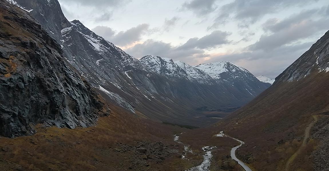
The Norwegian Public Roads administration Statens vegvesen and the Norwegian University of Science and Technology (NTNU) organized a proof-of-concept event in October of 2021 to bring together various government agencies to evaluate use of the latest LiDAR and drone technology to help with avalanche risk monitoring. They’d chosen the areas surrounding the iconic road called […]
29 March 2022
The Association Mission Patrimoine Mondial (AMPM) is an organization created to manage the process for the city of Carcassonne (South of France) and its Sentinel mountain castles better known as “Les Châteaux Cathares”, to successfully obtain UNESCO World Heritage certification. Built in the 13th century, the combined site is an exceptional example of military architecture […]
9 March 2022
YellowScan Global Support Community adds first Aussie Organization to Growing List Montpellier, France and Sydney, Australia – March 9th, 2022 – YellowScan, a global leader and designer of next generation manned and unmanned LiDAR solutions, announces the latest addition to its long list of YellowScan Global Partners Network, Sphere Drones. Founded in 2012 by Paris […]
What is the Challenge? Hepta Airborne, YellowScan’s Estonian based customer, won a contract with the Portuguese DSO (Distribution Service Operator) E-REDES, to launch a project with the objective of proving that drones can collect aerial inspection data just as well as manned helicopters missions. The plan was to compare data collected by drone to a […]
22 February 2022
Discover our new partner in Greece Montpellier, France and Maroussi, Greece – January 20th, 2022 – YellowScan, a global leader and designer of next generation of LiDAR solutions, announces an addition to its global distribution network, JGC. Established in 1999, JGC offers the Greek market the most technologically advanced Geoinformation Systems and satisfies the highest […]

11 February 2022
Explorer, the versatile LiDAR that can do it all YellowScan has signed a purchase agreement with Instradone. Instadrone will be the 1st customer in France to receive the YellowScan Explorer. Instadrone’s purchase is the latest endorserment for the Explorer and reaffirms the strong market of versatile LiDAR that can be mounted on a drone or […]
27 January 2022
YellowScan Global Support Community adds China to growing list countries covered Montpellier, France and Beijing, China January 13th, 2022 – YellowScan, a global leader and designer of next generation manned and unmanned LiDAR solutions, announces the latest addition to its long list of YellowScan Global Partners Network, EcoTech Ltd. Established in 2002, EcoTech is an […]
13 January 2022
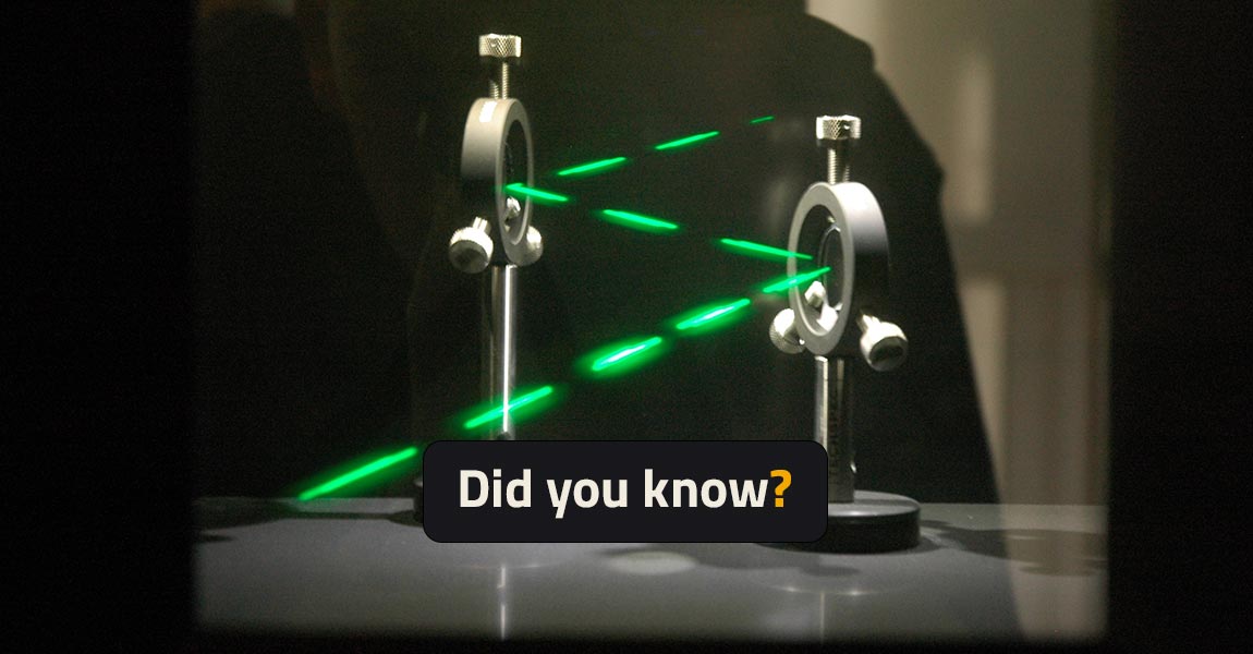
Did you know – Lasers classification For safety reasons, Lasers are classified depending on their potential risk of injuries to humans’ eye and skin. By law, all lasers products must have a label mentioning the class level. This number can be written either in Arabic numeral or in Roman numeral. In the case of European […]
13 December 2021
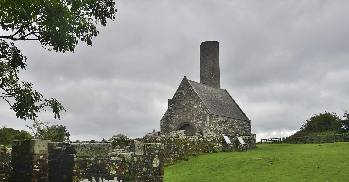
GeoAerospace, an Irish geospatial Data-as-a-Service provider, was contracted to provide high density LiDAR and high resolution orthophotography maps of Holy Island, a historic monastery on an island in Lough Derg, Ireland. The final data would become part of an archaeological assessment of the monastery. Digital Replica of Holy Island mission, © GeoAerospace 2021 What is […]
24 November 2021
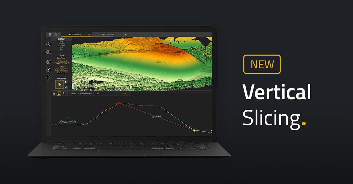
Latest feature in the YellowScan CloudStation helps users get a better understanding of generated point clouds. Check out this new feature in our CloudStation: Vertical Slicing! This new vertical slicing feature comes with CloudStation Core release 2110.0.0 as an additional tool. Vertical slices will help you get a better understanding of your generated point cloud. […]
10 November 2021
What is the challenge? The gypsy moth is an invasive species that can devastate forest canopies. In Vermont the gypsy moth is normally kept in check by a fungus, but abnormally dry conditions prevented the fungus from thriving resulting in an explosion of gypsy moth caterpillars. By June, the region was suffering the largest infestation […]
2 November 2021
The Intergeo 2021 Conference was held on September 21-23 in Hannover, Germany. https://youtu.be/DnhsuUv9q50 We were excited to be back in-person at Intergeo 2021 after nearly 2 years of not being able to attend a conference physically! Over 3 days we were busy chatting away at our booth with a steady flow of conference attendees stopping […]
4 October 2021
Commercial drone exhibitors and attendees gathered for Commercial UAV Expo Americas 2021, held September 7-9, 2021 at the Mirage in Las Vegas. Day 1 Today was a hot beginning to the UAV Expo event. Most of the day was taken up by live demonstrations at a testing site located outside Las Vegas (It was 43C […]

29 September 2021
Newest member of YellowScan’s global community strengthens an already impressive European presence Montpellier, France and Duderstadt, Germany – September 29th, 2021 – YellowScan, a global leader and designer of next generation of UAV LiDAR solutions, announces an addition to its global distribution network, MOST Robotics. As an innovative German manufacturer of drone systems, MOST Robotics […]
Building on the recent launch of our Explorer high-end solution, Mapper+ brings more features and options to our successful mid-range solution offering. Montpellier, France – September 21st, 2021 – YellowScan, a global leader and designer of next generation of UAV LiDAR solutions, is proud to announce today the launch of newest LiDAR addition to our […]
21 September 2021
Our new flagship offering can be mounted on a light manned aircraft or switched to different types of UAV platforms Montpellier, France – September 7th, 2021 – YellowScan, a global leader and designer of next generation of UAV LiDAR solutions, is proud to announce the launch of our latest technological innovation, the YellowScan Explorer. The Explorer […]
8 September 2021
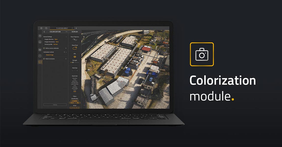
Latest add-on for the YellowScan CloudStation makes it easier than ever to colorize and visualize your data in a few clicks Montpellier, France – June 24rd, 2021 – YellowScan, a global leader and designer of UAV LIDAR solutions, announces the immediate availability of its new software add-on module: Colorization. This third software module enhances the […]
15 July 2021
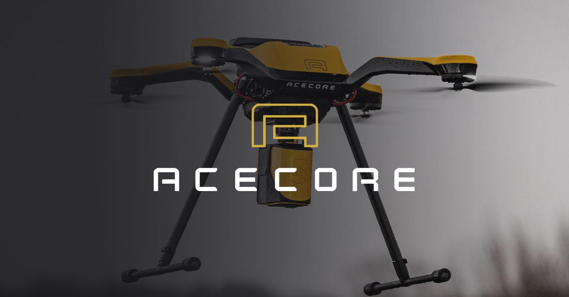
The YellowScan Mapper and Acecore Zoe combine to offer best-in-class highly accurate point cloud data and flight versatility in one package. Montpellier, France and Uden, Netherlands – June 2nd, 2021 – YellowScan, a global leader and designer of next generation of Unmanned Aerial Vehicles (UAV) LiDAR solutions, announces a new product collaboration with Acecore Technologies […]
2 June 2021
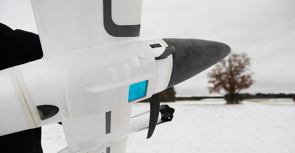
The Qube 240 payload is a geomatics grade LiDAR Scanner for the Trinity F90+ UAV and it is up to 60 min of flight time in this combination. It is offered as a complete solution, rounded up with YellowScan CloudStation Software pack, and license. Gilching, Germany, February 22nd, 2021 Light Ranging and Detection (LiDAR) sensors, […]
13 March 2021
Add-on for the YellowScan CloudStation suite improves accuracy and ease of use for point cloud rendering YellowScan, a global leader and designer of next generation of UAV LIDAR solutions, announces the immediate availability of its new software add-on module: Terrain. This new module enhances the processing power of CloudStation, YellowScan’s powerful data processing tool […]
16 February 2021
Did you know? There are different scan patterns of LiDAR systems depending on the scanning method used. You may know how a LiDAR system works – measuring the travel time between the emission of a laser pulse and the reception of the signal that is reflected by a target. But have you ever wondered what […]
5 February 2021
Did you know? It is not recommended to use LiDAR in rainy or foggy weather. In contact with water, light deviates and so does the laser of a LiDAR system, thus impacting data quality. The main optical process occurring with fog is diffusion as for rain it is dispersion. In the first case, the light […]
26 January 2021
Did you know? There are three different ways to determine distances using LiDAR. LiDAR sensors are based on the use of one or multiple laser beams to perform distance measurements. They are active sensors, emitting radiation at a set wavelength and receiving the return signal. There are three main techniques for determining a distance measurement […]

24 November 2020
eVTOL and UAV LiDAR solutions used for a large-scale survey in Sumatra One of the biggest challenges of LiDAR surveys is productivity. In what follows, you will realize how efficient can be LiDAR mapping when you use and combine the right tools: UAV and LiDAR system. Indonesia has a big development program ending in 2024. […]
Why use DJI drones for LiDAR mapping? With the advancements in drone technology, what used to take weeks or even months to map can now be accomplished in a matter of days. DA Jiang Innovation, more known under DJI name is the number 1 drones manufacturer in the world. DJI drones are drones you must […]
1 October 2020
Interview: Hi Bjarke, thank you for accepting this interview! We know you have used YellowScan Surveyor for your biodiversity research work. Can you tell us a bit more about you and your research work? I am Bjarke Madsen from Aarhus University in Denmark. I have been a PHD Student for 3,5 years at Ecoinformatics and […]
28 September 2020
The differentiator for Diodrone is the high quality of the data they can collect thanks to YellowScan solutions. What is the challenge? Diodrone’s client is responsible for managing geotechnical risks along a 170km long rural road which travels through remote and rugged terrain in Australia that is prone to landslides. Diodrone conducts routine inspection and […]
21 September 2020
YellowScan has more than one way to reach centimeter-level accuracy. YellowScan LiDAR solutions use Applanix GNSS-aided INS boards allowing for multiple post-processing methods to reach centimeter-level accuracy. Using a dual-frequency GNSS receiver, like the one used in YellowScan LiDAR systems, can locate itself at a meter-level accuracy. However, most of today’s survey jobs require centimeter-level […]
25 August 2020
Another specificity of LiDAR wavelength: atmospheric absorption. A sun beam emits up to 150K lux. It is like receiving light from 15,000 candles at the same time. One that is direct or reflected, can be misinterpreted by the LiDAR and be considered as a laser return. The water molecules in the atmosphere absorb a good […]
21 July 2020
LiDAR wavelength is in the infrared range due to detector efficiency. Among all the existing wavelengths, why would one use infrared instead of other ones (UV, visible)? Most LiDARs wavelengths are in the infrared range as is the case for YellowScan systems: 903 or 905 nm. One of the objectives of the LiDAR system is […]
What should you consider for a successful UAV LiDAR integration? UAV LiDAR integration is key to start a mapping business for safety reasons but not only (productivity, quality of deliverables…). Here are 6 main things to consider: 1. UAV system endurance: 20+ minutes with a minimum 2kg payload is required. If not possible then you […]
7 July 2020
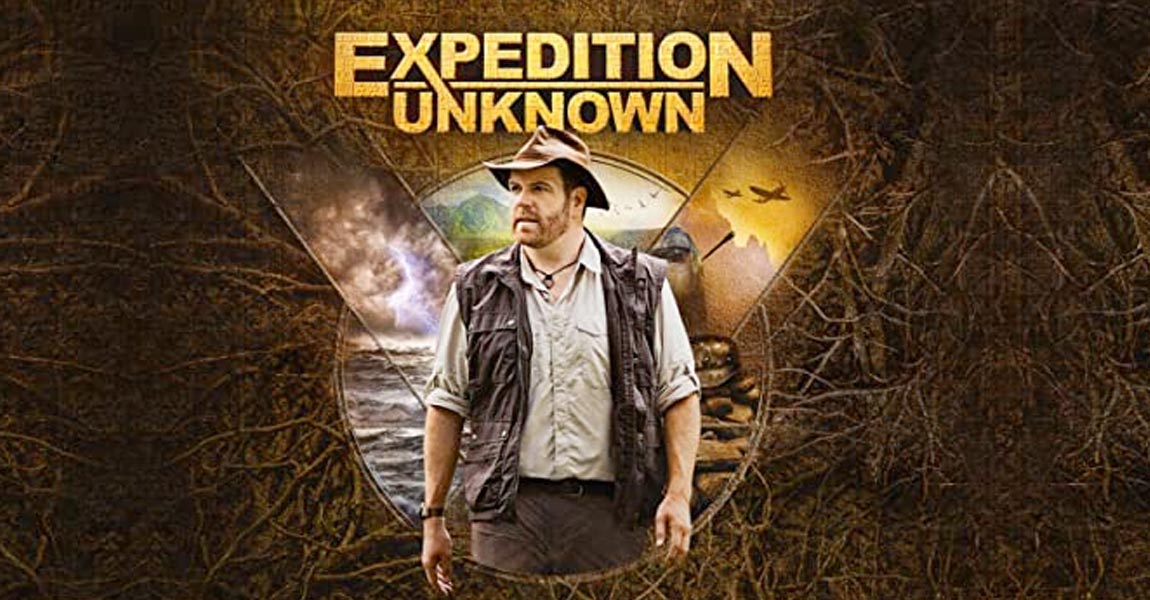
How UAS laser scanning helps archaeology On D-Day, Normandy was the theater of a massive firefight. 75 years later, we still have not found all buried structures from that period. In a field, not far away from Omaha beach, Josh Gates, presenter of the US TV show “Expedition Unknown”, is seeking new World War 2 […]
1 July 2020
The GPS position of LiDAR drones uses the General relativity, a theory of gravitation that was developed by Albert Einstein between 1907 and 1915. In order to understand this sentence, it is important to remember how a Global Positioning System (GPS) works. Satellites orbiting the Earth transmit information about their position and current time at […]

17 June 2020
Before LiDAR, mapping was done by combining the triangulation and levelling techniques. What is triangulation? Remember your math lessons! The sum of the angles of a triangle equals π radians (180 degrees), the law of sines and the law of cosines, Pythagoras’ theorem, trigonometry… does that mean anything to you? It’s due to these elements […]

29 May 2020
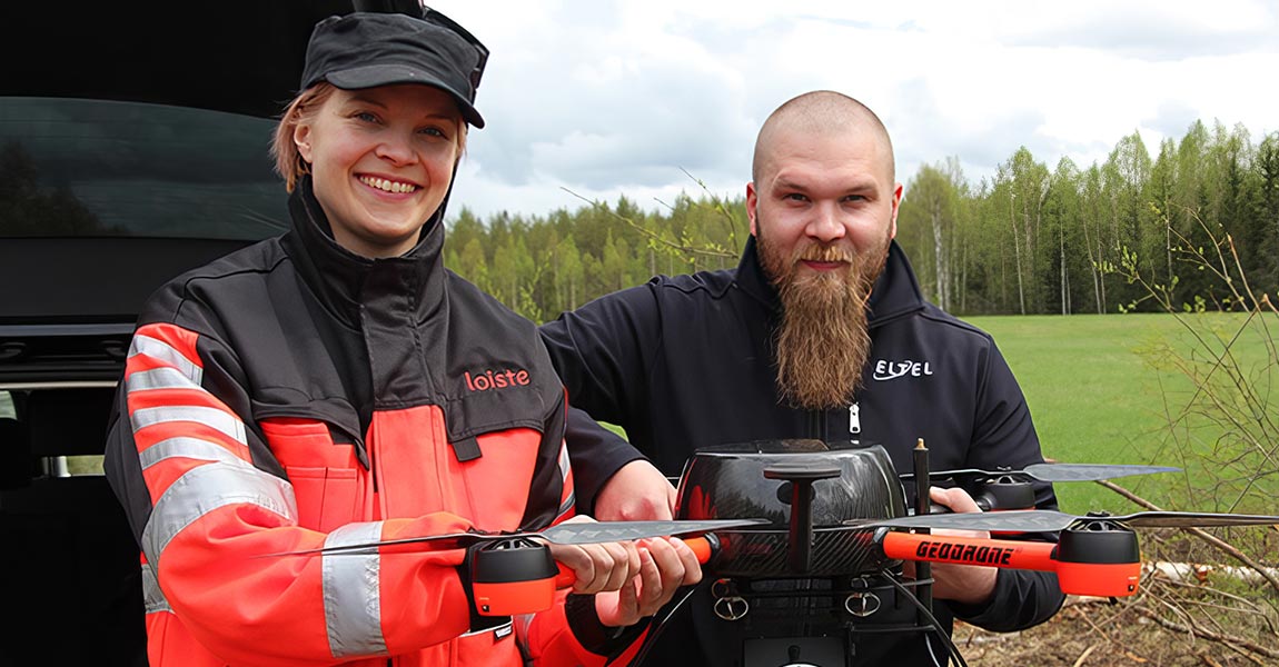
LiDAR for Drone mapping make Powerline network management easy Eltel, a Nordic field service provider for power and communication networks, conducted in 2019 a pilot study with Loiste a Finland-based energy company. The aim of the project was to investigate how drone LiDAR can be used for power grid design, maintenance and issue solving. Loiste, […]
28 May 2020
The difference between LiDAR (Light Detection And Ranging) and RADAR (Radio Detection And Ranging) is their wavelength. Although the basic purpose of LiDAR and RADAR is the same – detecting the presence and volume of distant objects – it is essential to understand the difference between these two technologies. Light Detection and Ranging (LiDAR) is […]
20 May 2020
3D point clouds triumph over theodolite method at thermal power station Until acquiring its YellowScan Vx-15 for 3D mapping, Ukraine’s EverScan used classic methodology (GNSS, Total Station, etc.) that took much longer to survey and hindered its engineers from achieving high accuracy. Moreover, the data they were acquiring was extremely redundant in terms of providing […]
14 May 2020
Flying LiDAR gives French company a competitive edge for Bali civil engineering and mining surveys Arnaud Denisot is a young IT engineer who decided to change his life. Four years ago, he left his job at La Défense, the Paris-region version of Silicon Valley, and re-established himself with a drone services company headquartered in the […]
13 May 2020
Page 1 of 2


