


Quantum-Systems introduces geomatics grade, high-speed scanning LiDAR – powered by YellowScan

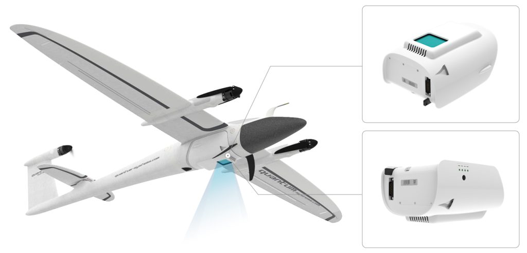
The Qube 240 payload is a geomatics grade LiDAR Scanner for the Trinity F90+ UAV and it is up to 60 min of flight time in this combination. It is offered as a complete solution, rounded up with YellowScan CloudStation Software pack, and license.
Gilching, Germany, February 22nd, 2021 Light Ranging and Detection (LiDAR) sensors, partly traded as the key technology of the future for autonomous driving are also the first choice for highly productive survey tasks.
Until recently, LiDAR payloads were hardly affordable for SMEs due to their high cost. This is exactly where Quantum-Systems and YellowScan come in and offer a geomatics grade LiDAR scanner integrated into the payload compartment of the Trinity F90+ drone including software package without having to compromise on data quality.
A geomatics grade LiDAR solution from a single source
The Qube 240 LiDAR provides essential information for surveying and mapping by generating an accurate 3D image of the process environment through 240.000 distance measurements per second.
Oustanding absolute accuracy is achieved with the help of the integrated Applanix APX15 INS. One can speak of a geodetic accuracy that was previously only achievable with LiDAR Systems of the upper price segment. The easy handling and user-friendly integration will convince customers. Fast and easy processing of the raw data is an additional benefit.
The solution comes with YellowScan CloudStation software which is enclosed in an adapted variant with a 1-year subscription license.
Ideal applications for the usage on board UAVs are in the following application scenarios:
- Power Line Surveying and Mapping
- Forestry & Agricultural Surveying and Mapping
- Mobile Surveying and Mapping
The Qube 240 convinces professionals with 240,000 shots per second, for which up to three reflections are measured. The result impresses on one hand with an extremely high point density with 50-100 points per square meter, and on the other hand with very good penetration of the vegetation. This way, the creation of digital terrain models under forest is also possible without any problems.
All in all, I do not know of any comparable solution worldwide, considering the weight, the performance, and the accuracy. We are especially pleased to be able to offer our customers a novelty for our Trinity F90+ UAS.

Features and availability of the Qube 240 LiDAR
The development and technical integration began in the second half of 2020 based on the cooperation with YellowScan. Which was already in years of existence. We achieved our goal to develop a geomatics-grade LiDAR sensor for our Trinity F90+ drone!
The result was a payload with unique key data:
- Geomatics Grade LiDAR
- Class 1 (Eye Safe)
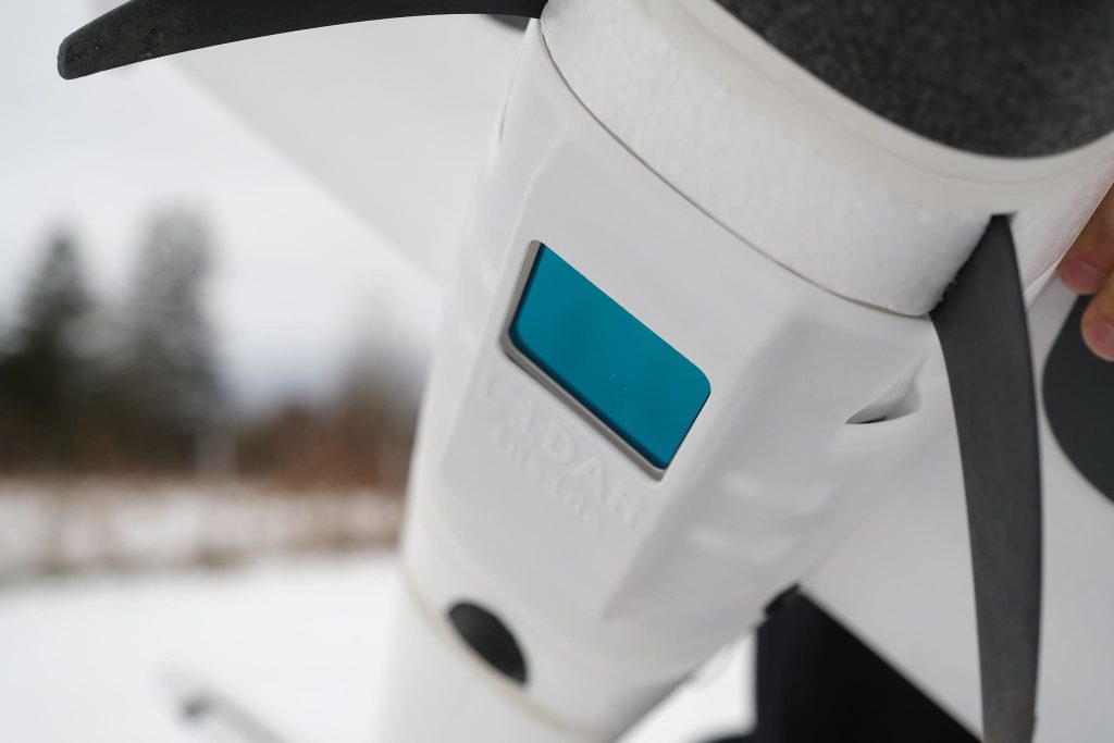
- Wavelength: 905 nm
- Maximum altitude: 140m AGL
- Precision: 1.8-2.5 cm
- Accuracy: < 3 cm
- Scanner field of view: 70°
- 240,000 shots per second
- Point density @100m: 50-100 points/m²
- Multi-echo technology: up to 3 echoes per shot
- Applanix POSPacTM UAV, GNSS, and INS software for PPK
- Qube240 data processing software to generate survey-grade LAS Files.
Impressive is the point density, even under vegetation and the low noise of the data. The sample data we collected so far also contains several GCPs some of which were covered with snow or are on loose ground and were measured 2 years ago. Nevertheless, one can see the extremely high accuracy of the system. The balanced representation of the intensity values of the point cloud is also striking. These values are in any case better than the intensity values of comparable or even more expensive systems, like Velodyne PUK32 systems.

About Quantum Systems
Quantum-Systems GmbH, founded in Munich in 2015, specializes in the development, design, and production of small Unmanned Aircraft Systems (sUAS).
Our sUAS combine eVTOL (electrical vertical take-off and landing) capabilities with long-range utilizing electrical and aerodynamic efficiency. We continuously integrate high precision sensors into our systems for increased aerial data intelligence. Using these methods, we are transforming decision-making processes for the professional user in both the commercial and governmental sectors.
About YellowScan
At YellowScan we design, develop, and build our UAV LiDAR solutions to exceed the expectations of professionals that require performance, robustness, and accuracy. Our complete hardware and software solutions are easy to use data collection tools coming with an unparalleled level of training and support from our experts.
Founded in 2012, YellowScan has customers around the world, and its products are used in surveying, forestry, environmental research, archaeology, industrial inspection, civil engineering, and mining sectors. Our innovative LiDAR solutions are complete hardware and software platforms, easy to use data collection tools combined with an unparalleled level of training and support from our experts.
Contact
Morgane Selve, Marketing Manager at YellowScan
For more information contact us at press@yellowscan-lidar.com