


Envie d’en savoir plus ?
Contactez notre équipe d’experts ou téléchargez la fiche technique de notre logiciel ci-dessous :
Logiciel de traitement LiDAR CloudStation.
Transformer des projets physiques en réalités numériques.
La CloudStation est un logiciel LiDAR évolutif et convivial, développé par YellowScan, pour générer et visualiser des nuages de points.
Notre logiciel vous offre une auto-détection des bandes, une configuration approfondie et l’exportation de fichiers LAS pour s’interfacer avec tous vos outils.
Changez votre façon de travailler avec les données LiDAR
Deux offres logicielles CloudStation sont disponibles :
Classification des nuages de points
Exportation de nuages de points classifiés en 3D
Ajustement des bandes
Modifiez les bandes ou les lignes de vol et améliorez la qualité de votre nuage de points.
Colorisation des nuages de points
Exportation de nuages de points colorisés à partir d’acquisitions simultanées LiDAR + caméra.
Caractéristiques principales :
- Combinez les données générées par votre vol avec les photos prises simultanément pour générer un nuage de points colorisé.
- Coloriez et visualisez vos bandes
- Calibrage et affinage automatiques LiDAR-caméra
- Deux méthodes de coloration disponibles
- Conçu pour notre matériel photographique
- Colorisation à partir d’orthophotos externes disponibles
YELLOWSCAN CLOUDSTATION
Une qualité de levé LiDAR de niveau supérieur
Conçu pour améliorer les données et fixer des normes élevées en ce qui concerne la qualité de vos projets d’arpentage.
![]()
10 ans d’expérience dans la technologie LiDAR
Notre objectif est de développer nos compétences et nos technologies pour mieux servir nos clients.
Notre équipe R&D s’efforce d’innover, de développer de nouvelles fonctionnalités et d’améliorer la CloudStation au quotidien, à tel point qu’une nouvelle version de la CloudStation sort toutes les 3 semaines.

Obtenez des conseils d’experts pour votre prochain projet de nuage de points
L’équipe compétente de YellowScan est là pour vous aider, qu’il s’agisse d’une consultation rapide ou d’une formation.
La CloudStation est proposée sous forme de licence annuelle avec une maintenance d’un an, comprenant l’assistance et les mises à jour logicielles.

Découvrez nos nuages de points en téléchargeant des jeux de données LiDAR
Découvrez des exemples de données capturées avec nos systèmes LiDAR, sélectionnez un capteur spécifique et téléchargez le jeu de données associé.

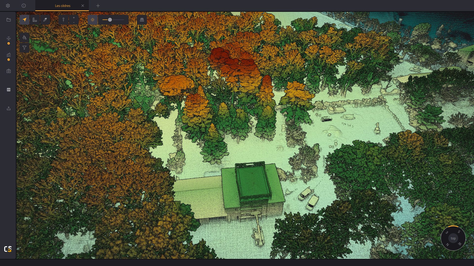
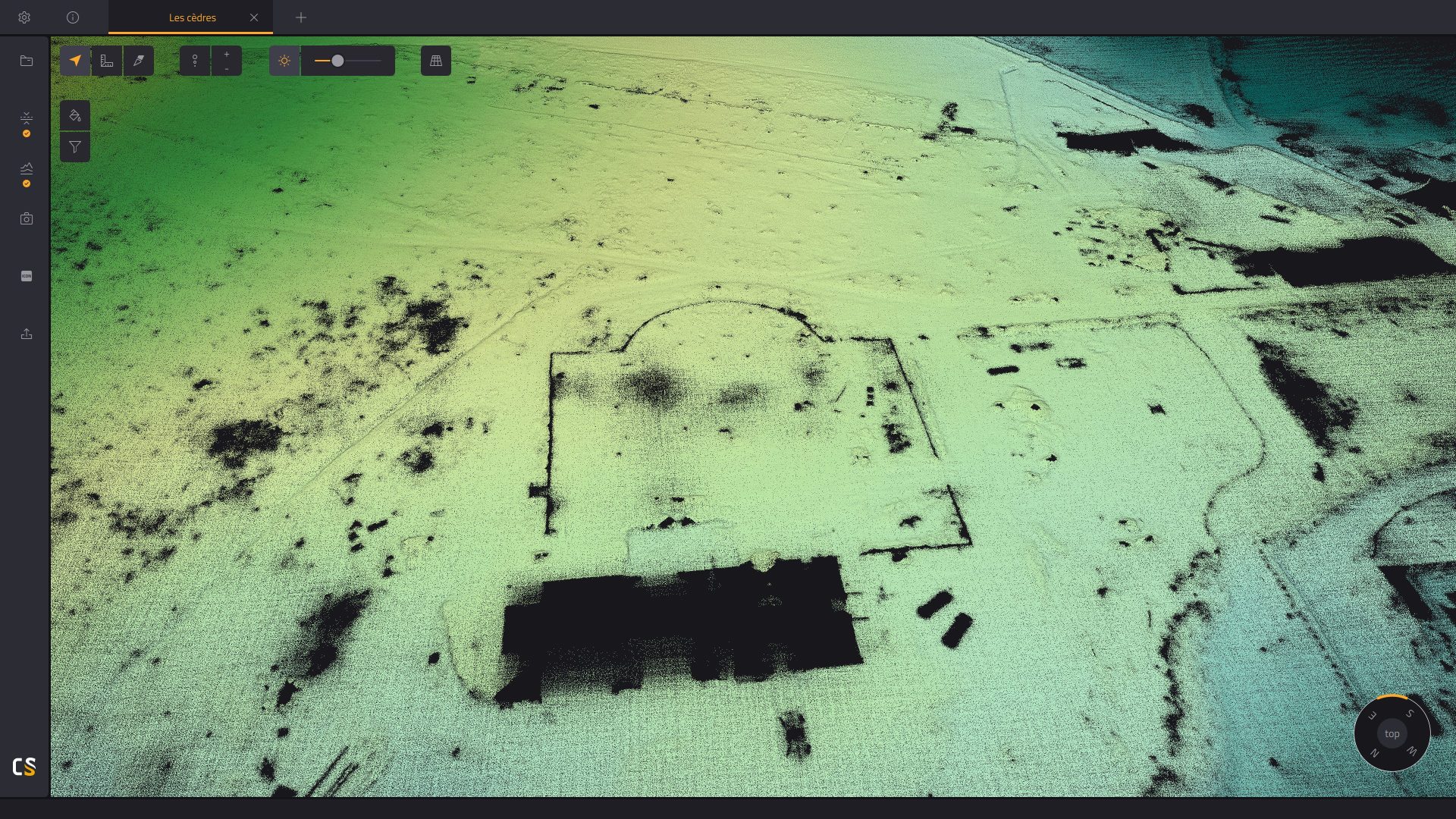
Visualisation, inspection et examen approfondi des nuages de points
Le puissant moteur 3D de la CloudStation vous permet d’afficher sans effort des milliards de points, de mesurer des distances et d’obtenir des informations sur vos points en un seul clic.
*Notre logiciel CloudStation est conçu pour être utilisé sur un ordinateur de bureau et n’est pas basé sur le cloud.

Augmentation de la productivité. Budget optimisé.
Extraire, traiter, afficher et exporter les données LiDAR immédiatement après le vol.
Gérer sans effort des acquisitions multi-vols dans un seul projet.
Affinez facilement votre trajectoire grâce à l’intégration du POSPac
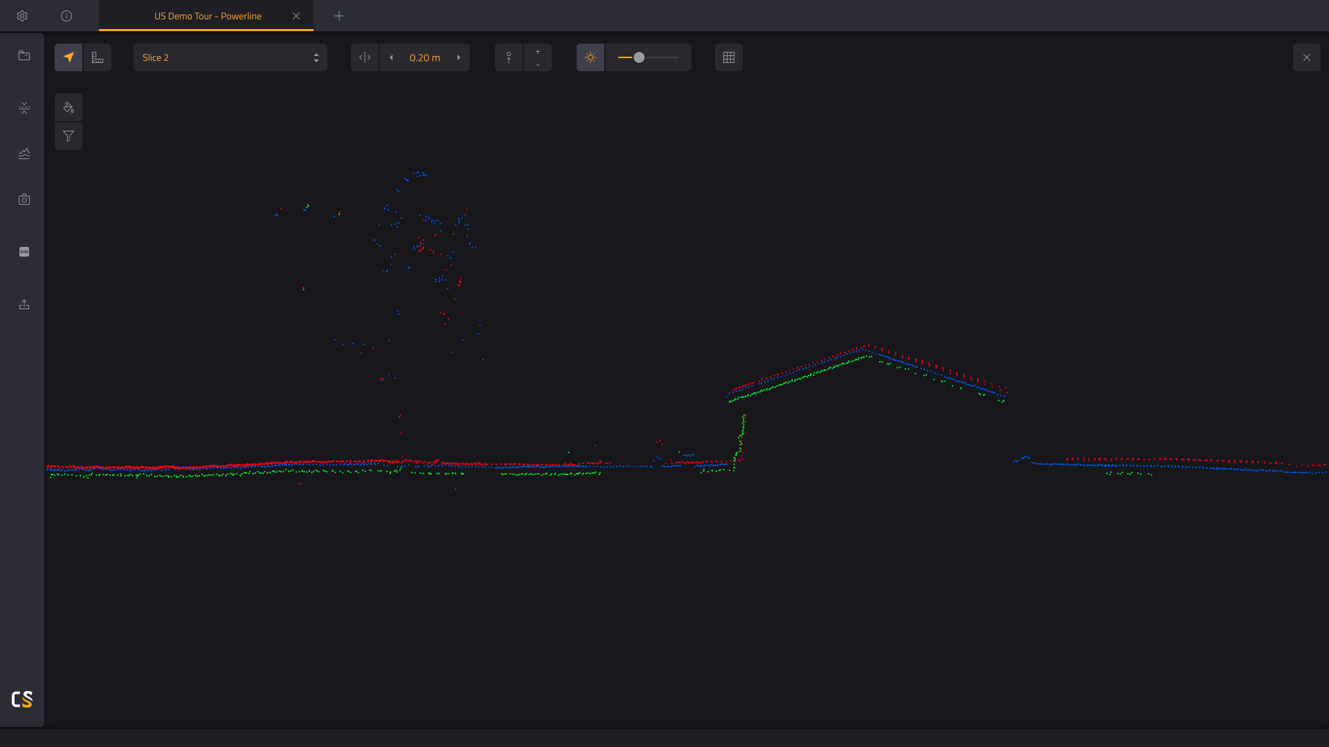
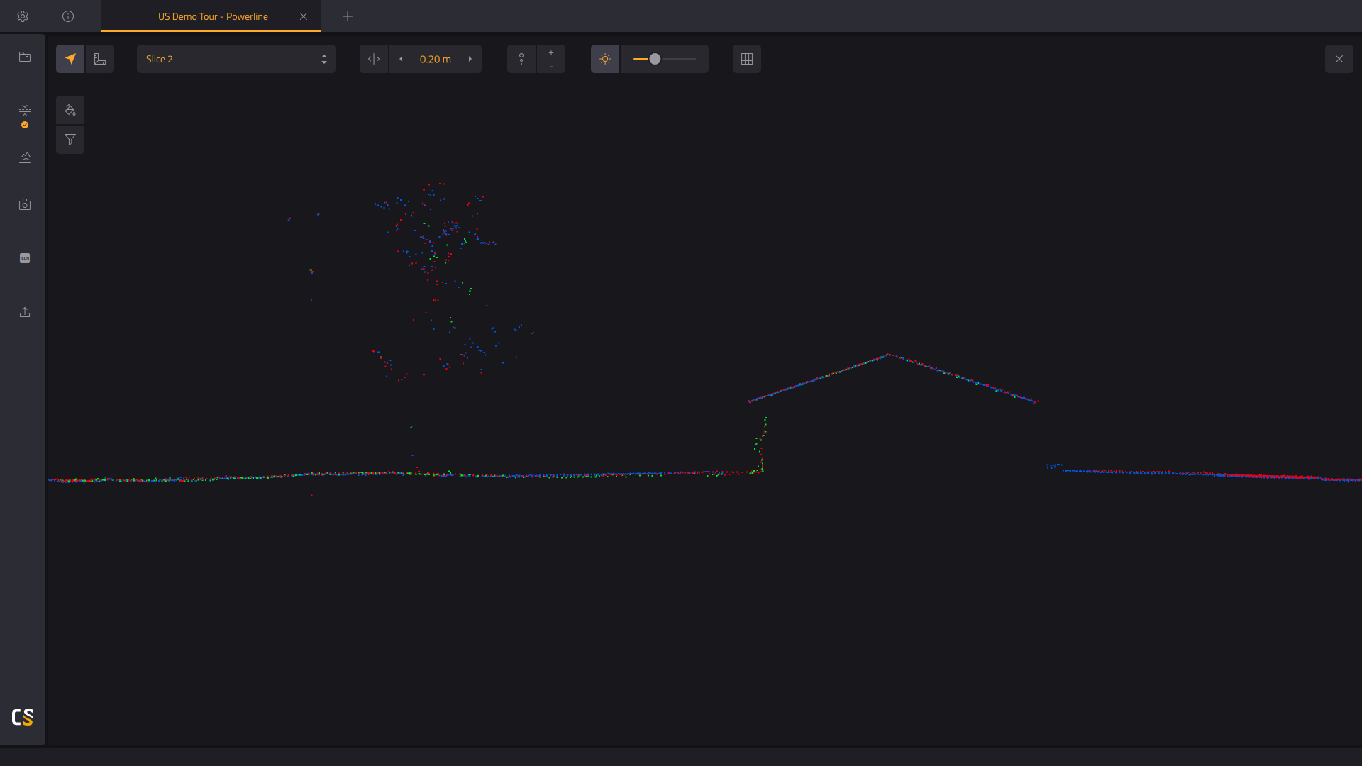
Coupe verticale du nuage de points généré
Obtenez une meilleure compréhension de votre nuage de points généré.
- Mesurer la dénivélation.
- Évaluer la qualité de la classification du sol en vérifiant la base des éléments verticaux.
- Vérifier le décalage entre les lignes de vol en mesurant la distance entre les bandes. Avant ou après l’ajustement des bandes.
